
Missoula County clears the way for redevelopment of Lolo School property
Martin Kidston
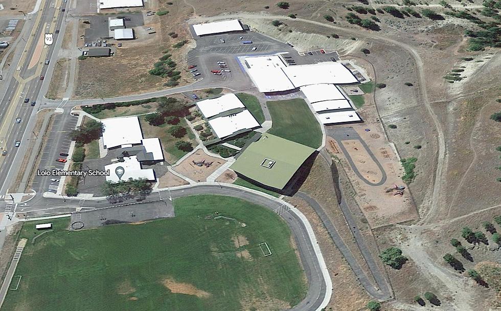
(Missoula Current) Missoula County on Thursday adopted amendments to its land-use map and growth policy to accommodate the redevelopment of the old Lolo School and surrounding property.
The Consolidated Planning Board last week unanimously recommended the changes. While the developer doesn't have any specific plans for the property just yet, amending the land-use map opens the door to redevelopment.
“We were trying to keep some flexibility there in case the developer saw some opportunity for commercial development, but also do residential if they don't find any buyers for commercial,” said Karl Treadwell with 406 Engineering.
MC Vines LLC sought the change from a public land designation to residential, commercial and ope space. The public land designation served the Lolo School but now that it has moved, the designation became a barrier to redevelopment of the property.
“Community commercial is more oriented toward a coffee shop, or local food. It was a request from what they (developers) heard from the Lolo community,” said county planner Lauren Ryan. “There's a lot of underutilized commercial space already in the Lolo area.”
The new designation allows for 16 acres of residential building and 14 acres of commercial while also setting aside 13 acres as open space. It also allows a density of 16 dwelling units per acre.
Commissioners approved the changes, saying they could be beneficial for Lolo.
“I think there's an opportunity for Lolo and the inner core of Lolo to really enhance the sense of community instead of generic, commercial sprawl,” said Commissioner Dave Strohmaier. “They have an opportunity to have a mixed-use development that accomplishes a few different goals.”